The Tour de Menlo website is your best source for current route information.
Download the Tour de Menlo 2025 bike routes from the website, which includes:
- Route maps and cue sheets
- Access via the Ride with GPS app
Upon registration, you’ll get a link to unlock enhanced features in the Ride with GPS app:
- Turn-by-turn voice navigation
- Cue sheets
- Interactive maps for all routes
- Downloading Ride with GPS and routes to your
phone or Garmin type device or uploading to Strava
Printed route sheets will be available on the day of the ride.
Please note that routes may be updated or changed due to unforeseen circumstances at any time prior to the event day.
The Ride
| Route | Elevation Gain | Start Time |
| 65-mile Route | 3687 ft | 7:00 am |
| 43-mile Route | 2016 ft | 8:00 am |
| 33-mile Route | 1164 ft | 9:00 am |
| 12-mile Family Ride | 404 ft | 10:00 am |
Ride Starts and Ends: The Church of Jesus Christ of Latter-day Saints, 1105 Valparaiso Ave, Menlo Park, CA
Route Markings and Color Codes
- Each route is marked with colored arrows at all critical turns
- On the day of the event, riders receive a wristband matching their route color
| 65 Mile Route https://ridewithgps.com/routes/47333177 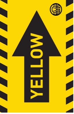 | 43 Mile Route https://ridewithgps.com/routes/47273883  | 33 Mile Route https://ridewithgps.com/routes/47276339  | 12 Mile Family Ride https://ridewithgps.com/routes/47276345  |
NOTE: The route number (i.e. 33, 43, 65) is not shown on the arrow – only the color of the route matters!
Where routes merge, you’ll see a multi-color arrow labeled “ALL”

65 Mile Route
The Tour’s most challenging route begins with a half-mile uphill on Edgewood Road, then goes north on Canada Road, crosses Highway 92, and continues onto Skyline Road. Riders then turn left onto the Sawyer Camp Trail, leave the trail to rejoin Skyline Road, and head downhill on Crystal Springs to the rest stop on Polhemus Road. After a brief rest, riders return south, cross Highway 280 via the Ralston Bike Trail, and head towards Canada Road. They cycle towards Woodside, turning at the 4-way stop onto Woodside Road. The estimated elevation gain for this route is 3,687 feet.
Joining the 43-mile route, riders head west on Portola Road to the Christ Church rest stop in Portola Valley. They then continue on Portola Road, turn onto Alpine and Arastradero Roads, and head towards Los Altos. After some climbs, riders join the Foothill College bike path, return to El Monte Road, and then head for Sycamore Park on Stevens Canyon Road for a rest stop and turnaround point. From Sycamore Park, riders return to the start via Stevens Cyn Rd and Foothill Expy and back to Valparaiso Road and ending with a delicious lunch at The Church of Jesus Christ of Latter-day Saints in Menlo Park.
![]() 65 Mile Route Map and Turn Sheet Download
65 Mile Route Map and Turn Sheet Download
43 Mile Route
This challenging route takes riders to the Alameda de las
Pulgas and then north to Woodside Road. Pass Interstate 280 on the climb up to Whiskey Hill Road. Riders will turn left onto Whiskey Hill Road and then right onto Sand Hill Road. Sand Hill Road will become Portola Road and, after a scenic ride through Portola Valley, riders will arrive at the rest stop at the Christ Church overflow parking lot, adjacent to the Portola Valley Town Center. After a brief rest, riders continue on Portola Road, turn left onto Alpine Road and then turn right onto Arastradero Road at the historic Alpine Inn.
The course will wind around Arastradero Road, with a short jaunt on Page Mill Road, and then into Los Altos, starting with a right turn on Purissima leading to some short climbs on Robledo, Elena and on to the Foothill College bike path. From there, the route winds its way back to Foothill Boulevard and on to Stevens Canyon Road and then to beautiful Sycamore Park.
From Sycamore Park, riders return to the start via Stevens Cyn Rd and Foothill Expy and back to Valparaiso Road and ending with a delicious lunch at The Church of Jesus Christ of Latter-day Saints in Menlo Park. The estimated elevation gain for this route is a comfortable 2,016 feet.
![]() 43 Mile Route Map and Turn Sheet Download
43 Mile Route Map and Turn Sheet Download
33 Mile Route
This is the perfect route for beginners or riders who prefer an easy, virtually flat ride down the Peninsula. From the start at The Church of Jesus Christ of Latter- Day Saints at 1105 Valparaiso Ave. in Menlo Park, the course heads out Valparaiso to the Alameda de las Pulgas, Santa Cruz Ave, Alpine Rd, and a left on Junipero Serra Blvd across and then stays on Foothill Expressway all the way to Stevens Canyon Road and
the Sycamore Park rest stop.
From Sycamore Park, riders return to the start via Stevens Cyn Rd, Foothill Expy, Junipero Serra Blvd, Santa Cruz Ave, Orange Ave and back to Valparaiso Road, and ending with a delicious lunch at The Church of Jesus Christ of Latter-day Saints in Menlo Park. With an estimated total elevation gain of only 1164 feet, this is the perfect route for beginners or riders who prefer an easy, virtually flat ride down the Peninsula.
![]() 33 Mile Route Map and Turn Sheet Download
33 Mile Route Map and Turn Sheet Download
12 Mile Route
The Tour’s route for those that are not avid cyclists or wish to do the ride with their families. This route is the same as the 33-mile route except riders will turn around at the water rest stop on Miranda Ave in Palo Alto. The ride will start at The Church of Jesus Christ of Latter-day Saints at 1105 Valparaiso Ave. in Menlo Park. The course heads out Valparaiso to the Alameda de las Pulgas, turns south across the Stanford campus and then stays on Foothill Expressway. Riders will retrace their route back
to the starting point and a delicious lunch. With an estimated total elevation gain of only 400 feet, this is a perfect course for riders who are not interested in hills.